Market:
Mining, Environmental Compliance
Location:
Mpumalanga
Project Objective:
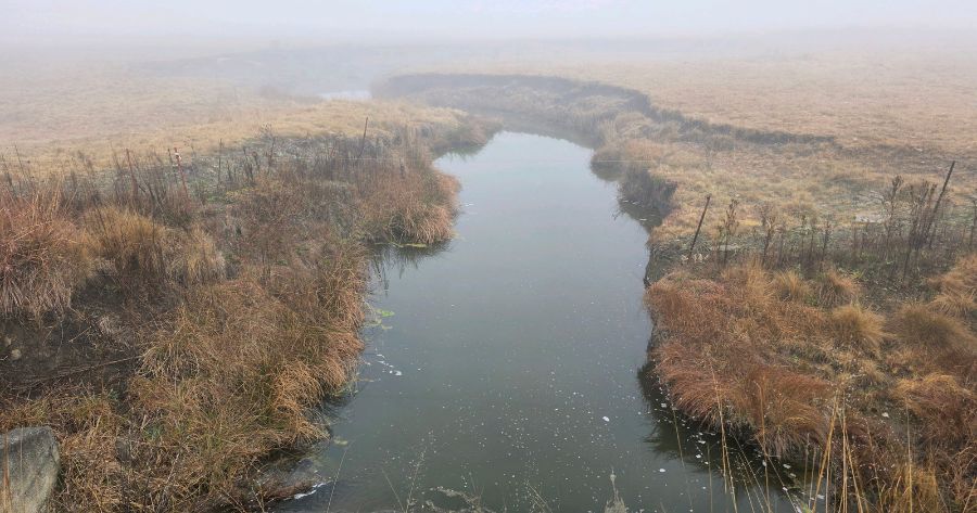
This watercourse study aimed to delineate all watercourses within the study area in accordance with the Department of Water and Sanitation’s “A Practical Field Procedure for Identification and Delineation of Wetlands and Riparian Areas (DWAF, 2005)” and any subsequent updates. The delineation results will provide the foundation for updating the mine’s Wetland Management and Rehabilitation Plan, as required under WUL number 10/C11K/CFGIJ/4524, and will inform future planning, environmental compliance, and rehabilitation activities across the mine’s surface infrastructure and disturbed areas. The Present Ecological State (PES), Ecological Importance and Sensitivity (EIS), as well as the opportunity/effectiveness of the at-risk systems to supply valuable Ecosystem Services (ESS) to the surrounding catchment area, were determined using best-practice and legislated methodologies and techniques. Based on the calculated integrity of the watercourses and the perceived impacts identified, mitigation and/or rehabilitation measures were formulated to maintain the Recommended Management Objectives (RMOs), as determined using the Department of Water Affairs and Forestry (DWAF) (now the DWS) management matrix (DWAF, 2007).
Project Execution Strategy:
The project was executed through a structured desktop assessment, field verification, specialist assessment and GIS mapping process to ensure accurate delineation and classification of watercourses within the New Denmark Colliery mining right area. The approach was aligned with the DWAF wetland delineation guidelines, applicable DWS requirements and the mine’s Water Use Licence obligations.
The execution strategy comprised the following key phases:
Desktop assessment and planning
Available environmental, hydrological, biodiversity and spatial datasets were reviewed to identify potential watercourses and areas requiring field verification. This included aerial imagery, NFEPA, National Wetland Map 5, SAIIAE, NBA, biodiversity planning information and relevant catchment data.
Field survey and watercourse delineation
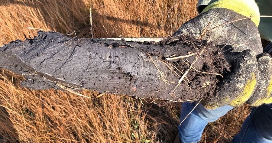
A specialist field survey was undertaken from 23 to 25 June 2026. Potential watercourses were verified using terrain, soil, hydrological and vegetation indicators in accordance with the prescribed wetland delineation methodology. Where access was restricted, desktop interpretation was used to supplement the field assessment.
Watercourse classification and assessment
Identified watercourses were classified to Level 6 using the National Wetland Classification System. At-risk systems were further assessed in terms of Present Ecological State, WET-Health, Ecosystem Services, Ecological Importance and Sensitivity, and Recommended Ecological Category.
GIS mapping and buffer determination
Field observations and desktop datasets were integrated within QGIS and Google Earth Pro to produce detailed watercourse delineation maps. Scientifically justified buffer zones were incorporated to support future planning and protection of aquatic resources.
Management and rehabilitation recommendations
Identified anthropogenic pressures, including agricultural activities, road crossings, farm dams, erosion and hydrological modifications, were considered in developing practical mitigation, monitoring and rehabilitation recommendations. The outputs were structured to support updating the NDC Wetland Management and Rehabilitation Plan and future environmental planning and compliance.
Reporting and quality assurance
The findings were consolidated into a specialist report incorporating the methodology, delineation results, classification, assessment outcomes, limitations, maps and management recommendations. The report was subject to specialist review and professional sign-off before finalisation.
Project Key Achievements:
The assessment incorporated a detailed desktop review, field verification of wetness indicators, hydrogeomorphic (HGM) classification, and the identification of anthropogenic stressors affecting the aquatic environment. Watercourse boundaries were delineated using the prescribed terrain, soil and vegetation indicators, with field verification undertaken wherever site access permitted. In areas where access restrictions prevented field verification, delineations were based on desktop interpretation supported by aerial imagery, topographic information and available spatial datasets.
A total of twenty-three watercourse units were identified and classified. These systems comprise a combination of floodplain wetlands, channelled valley-bottom wetlands, seep wetlands and depression wetlands that collectively form an important component of the regional freshwater network. The study confirmed that the mining right area supports numerous natural watercourses despite extensive historical agricultural activities and existing mining-related infrastructure.
The study area remains predominantly influenced by agricultural land use, with localised impacts associated with roads, farm dams and rural infrastructure. These activities have resulted in varying degrees of hydrological modification, fragmentation of riparian habitat and disturbance of natural vegetation within portions of the study area. Nevertheless, many of the delineated watercourses continue to retain important ecological functions and contribute to landscape-scale hydrological connectivity, water quality regulation and biodiversity support.
The delineation boundaries and associated 25 m recommended buffer zones presented in this report should be incorporated into future planning, operational management and rehabilitation activities across the mining right area. These delineations provide the most accurate representation of the current extent of the watercourses and should be used to guide infrastructure planning, maintenance activities, rehabilitation initiatives and environmental authorisations where applicable.
To ensure the continued protection of these aquatic resources, it is recommended that the proposed monitoring programme continue to be implemented and that routine inspections be undertaken to identify changes in hydrology, vegetation condition, erosion, sedimentation, alien invasive plant infestations and other anthropogenic disturbances. Rehabilitation and management interventions should focus on maintaining natural hydrological processes, protecting riparian habitat, controlling alien invasive plant species and minimising further disturbance within and adjacent to delineated watercourses.
Project Tags:
Wetland Delineation, Wetland Assessment, Aquatic Ecosystems, Watercourse Management, Wetland Management, Wetland Rehabilitation, Environmental Planning, Environmental Compliance, Freshwater Ecosystems, Biodiversity Conservation, Mining Environment, Sustainable Mining, Environmental Consulting